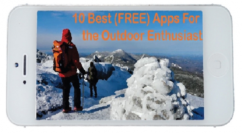
10 Best (FREE) Apps for the Outdoor Enthusiast
Not everyone agrees that smartphones have a place in the outdoors. For me, the trick is to use smartphone apps in the outdoors that will enhance the experience, not to become the experience. For example, sometimes while hiking I want to know how far it is to the top so I whip out my free altimeter app. But often, I’m really not looking to purchase a $10 smartphone app for an entire topographic map of the United States or Audubon’s complete bird guide. For things like that, personally I’d rather have a map or a book; something that I don’t have to rely on having cell phone service or battery in order to use.
This is why I present to you a list of my top ten favorite free outdoor apps. Often free apps are incomplete versions of the full cost app, but in my experience they are pretty good for paying absolutely nothing. And if you really love the app, you can always buy the complete version. While at this point it has become cliché, no matter how you like to enjoy the outdoors, there really is “an app for that.”
1) Project Noah

Noah enables users to post their encounters with nature (sound familiar?) from their phone. By handing out essentially “mobile butterfly nets” to the smartphone users of the world, Project Noah aims to build the go-to platform for documenting all of the world’s organisms. By crowd sourcing wildlife encounters, they are able to collect vast amounts of photos and data on wildlife distribution, abundance, and phenology. As user you can earn virtual patches and complete virtual missions by uploading your nature photos as well as browse the field guide that Project Noah has already compiled through encounters by other users. By putting this technology on a mobile device Project Noah has made citizen science more accessible than ever.
2) MTB Project
MTB Project is a great resource for the avid mountain biker. Whether you’re traveling and want to go mountain biking in a new area or you are near your home base, MTB Project is an app you should try. This app has done a great job of mapping trails all over the country and making them available to the general public. By first downloading your local map (i.e. Vermont, New York, etc.) you will gain access to the MTB Project trails database for the entire state. Put your finger to any dotted line on the map and the distance, ascent, descent, and highest and lowest elevation of that trail will appear. Some trails also have specific reviews written by the MTB Project team. However, it should be noted that many of the North Country trails such as Donnerville, Stone Valley, Seven Springs are not yet included. But it does include miles of recorded and mapped trails in the Saranac Lake/Lake Placid area.
3) Leafsnap
Have you ever been walking in the woods and saw this amazing tree but had no idea what it was? Well now there’s an app for that. Leafsnap is the first in a series of field apps being developed by Columbia University, the University of Maryland, and the Smithsonian Institution. Using visual recognition software and GPS locating, Leafsnap works to identify tree species through user photographs of leaves. Just take a leaf sample, put it in front of a white background, and Leafsnap will give you a list of possible species from their database of almost 200 trees. Unfortunately, this app is only helpful if you are in the Northeast, New York, or Washington D.C.
4) AllTrails
No matter where you are or what your experience level is, AllTrails app will have a trail that you are sure to enjoy. This app has over 50,000 trails all over North America just waiting to be hiked, biked, or run. Each trail is complete with accurate reviews, photos, and descriptions. Similar to MTB Project, the AllTrails database is not complete as it doesn’t include many trails in the North Country. However, If you know of a local trail that isn’t on AllTrails you can create an account to add it to their database.
5) Geocaching (Intro Version)
What is geocaching? It is like a real-world outdoor treasure hunt with over 2,436,857 “treasure” locations worldwide. This app helps you navigate to GPS coordinates where a geocache is supposed to be hidden. This might be a great tool to get kids out and having fun in nature. However, since this is a review of free apps I am reviewing the intro version, which only shows caches in the user’s immediate area. If you decide later that you want to find more caches, the full app is available for $9.99.
6) Fishing Spots
Wanting to go fishing but don’t know where the good sports are? Fishing spots will be your guide to local areas to fish. The app includes interactive map enabling users to learn where others have caught fish, along with pointers, reviews, and photos. Users can also get access to the best times in the day to fish, sunrise and sunset, and the weather forecast for a specific location. If it is a popular spot then there is sure to be a lot of information already provided, and if it isn’t so popular you can post pictures and reviews yourself.
7) Merlin Bird ID
While there are many birding apps out there, I prefer Merlin Bird ID. This app is made by the birding experts at the Cornell Lab of Ornithology, the premier ornithology research group in the country. As a user, you can do two things with this app. If you see a bird and want to know what it is, with your current location, date, size of the bird, three general colors, and what they were doing when you observed them, the app will give you a list of possible birds you could have seen. With some close observation, often times you will be able to figure out which species you saw. When you find the bird you were looking for and click “that’s my bird” it helps Merlin become more accurate for future birders. On the other hand, if you just want to look up some information on a specific species you can do that to by browsing their extensive database of birds. The Merlin app has more bird species and accurate information than any other free (or paid) birding app I have come across.
8) Strava
Strava is a free app designed for the more competitive hiker, biker, or runner. By creating a free account you can record your chosen activity with a GPS. You can follow your routes and view your activity on a map as well as get important stats on your distance, pace, speed, elevation, and effort. Then, you can view how others did on the same trail and try to rise up the ranks to “king/queen of the mountain.” The app lets you share your activities on Facebook or cheer on your friends by giving them “kudos” on their activity. If you are a highly competitive athlete and want to compare your outdoor efforts with others, Strava may be the app for you. Strava is also a good tool for finding popular trails or routes in your area, but MTB project or Singletracks might be better for this purpose.
9) Sky Map
While not as fancy as Star Walk or other astronomy apps, Sky Map does have many of the main constellations with accuracy. All you have to do is point your device to the sky and Sky Map will tell you what you are seeing, whether it be a planet, constellation, globular cluster, or star. You can even search for a specific object and Sky Map will reveal an arrow that will point you in the right direction. The ads along the bottom of the screen can by annoying, but overall this app is great for summer nights outside with the kids!
10) ArcGIS
Maps on maps on maps. This app has a map for everything, whether you want to look at soil surveys, bedrock types, topography, demographics, recreation, or even glacial movements. While this is all interesting, for the outdoor enthusiast, I would recommend the U.S. topographic map. Most trails are marked with dotted lines and you can even calculate their distance using this app. This app can only be used with internet access (or 4G or LTE), but a good idea would be to take screenshots of where you will be heading before you go on your way. Disclaimer: Do not take for granted the practicality and reliability of an old fashioned map though.
Whether it be hiking up mountains or skiing down them, Macky loves to be outside in any capacity. As a summer intern here at Nature Up North, she can't wait to get involved in the North Country community!
Comments
Apps
Thanks for the list. I use iBird a lot. The calls are really useful. We also geocache and use google sky a bunch too.
I vote yes on SkyMap. There are also some GPS apps I like that make my iPhone useful for grabbing GPS coordinates for things (rather than e.g. for navigating a drive or a hike). My preferred GPS apps are Motion-X GPS and GPS kit, though neither is free. I've played with leaf snap some, and that is where, for me, I'd rather have a book.